
The process of creating a physical map of the Ovraiki Area of Hania, Crete, in partnership with Etz Hayyim Synagogue.
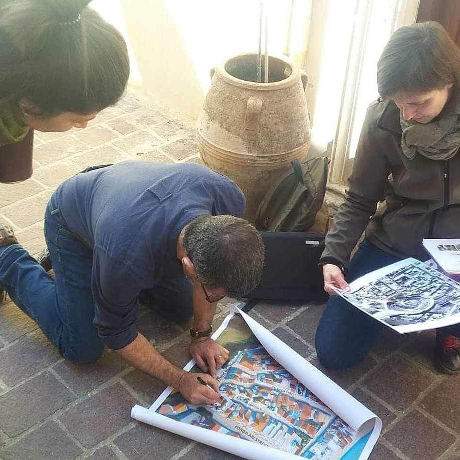
I had been working on my own volition, visually reconstructing a part of the old town of Chania, which used to house the majority of Crete's small Jewish community. The history of this area is documented in detail thanks to the archival research and efforts of the Etz Hayyim Synagogue, restored from its terrible state by Nikos Stavroulakis. Anja Zuckmantel the current director of the organisation has established the synagogue as a world destination, the last vestige of a community that sadly was wiped out in April 1941, when an allied torpedo destroyed a transit ship, the Tanais. On board, 300 Jewish people, some 200 Greek resistance fighters and Italian prisoners of war. Anja contacted me while I was working on the map and invited me on a residency, to work together in completing this project. Looking at the map's accuracy by comparing to aerial photographs and descriptions of the area during and after the war. A walk in the neighbourhood with staff and volunteers from the Synagogue and Chief Rabbi Gabriel Negrin, who flew from Athens for the occasion. Of particular interest was the exact location of the destroyed Beth Shalom Synagogue. A further meeting with a local historian whose work is often published in the local newspapers Mr. Manousakas contributed to the discussions. Here with director Anja and historian Katerina Anagnostaki.
I am very moved that during the process of mapping the area, we discovered the exact position of the other synagogue Beth Shalom which did not survive the war years. It is now on the map for posterity, as are the many stories of families that lived in the area, lovingly recovered from oblivion by the capable staff of Etz Hayyim. You can read more of teh process of creating the map and the residency here: https://georgesfougaras.blogspot.com/2019/02/map-hania-crete.html?view=flipcard